← Home · Excavations

Geotechnical Design of Deep Excavations in Murfreesboro

Together, we solve the challenges of tomorrow.

EXPLORE →

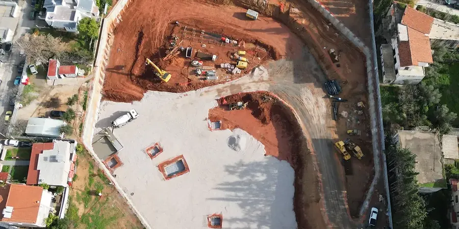
The biggest mistake we see in Murfreesboro is assuming a uniform cut will stand open through a Tennessee wet season. The top four to twelve feet of residual clay over weathered limestone looks stable on a dry afternoon, but it loses cohesion fast once water infiltrates the slope face. We have pulled cores on Medical Center Parkway jobs where the unconfined compressive strength of the rock varied by a factor of three within a single block. A geotechnical design of deep excavations here has to account for that spatial variability, not just a textbook bearing value. When we start a project, we cross-reference the boring logs with the Rutherford County soil survey and look for the Fort Payne chert layers that can fool a contractor into thinking the rock mass is more competent than it actually is. Often we pair the design with CPT testing to get continuous tip resistance profiles through the transition zone between the clay residuum and the pinnacled bedrock surface.

An open cut in Murfreesboro limestone can lose twenty percent of its stand-up time after just one week of rain.

Scope of work

Drive fifteen minutes from the Blackman area over to the Gateway district and the excavation support logic changes entirely. Blackman sits on thicker sequences of the Ridley Limestone with intermittent chert beds, and the rock quality designation runs higher, so we can often design a near-vertical cut with pattern rock bolts and shotcrete facing. Gateway is wetter, with more clay-filled solution channels and a perched water table that sits only eight to twelve feet down after a normal spring. Our geotechnical design of deep excavations there has to include horizontal drains and a stiffer soldier pile spacing because the clay swells when the water table rises. Before finalizing the shoring sections, we run the lab program through the sieve stack and Atterberg limits, and we calibrate the lateral earth pressures against the triaxial test results measured on Shelby tube samples taken from the active zone depth. For projects near the Stones River floodplain we also check the bottom stability with a basal heave analysis, because the soft alluvium can squeeze under the excavation mat if the embedment depth is cut too tight.
Geotechnical Design of Deep Excavations in Murfreesboro
Technical reference image — Murfreesboro

Area-specific notes

The karst geography of the Nashville Basin puts Murfreesboro in a different risk category than the alluvial plains further west. We are not just fighting soil pressure; we are fighting the unpredictability of a weathered rock surface that can drop eight feet across a single column line. A geotechnical design of deep excavations that ignores the possibility of a clay-filled grike or a dome collapse structure can result in a sudden loss of ground, flooding the excavation through a previously tight rock seam. The winter freeze-thaw cycles open up the chert joints, and then the spring rains pressurize the clay infill until it sloughs off the cut face in large blocks. Our team mitigates this by combining probe hole drilling ahead of the excavation face with grouting of the largest solution features before the main earthworks begin, so the shoring system loads are transferred to a more continuous rock arch.

Need a geotechnical assessment?

Reply within 24h.

Email: contact@geotechnicalengineering.biz

Technical parameters


ParameterTypical value
Design groundwater elevationTop of Fort Payne chart / perched zone
Lateral earth pressure modelApparent pressure diagrams (FHWA) for mixed face
Rock mass shear strengthGeneralized Hoek-Brown with GSI 35-55
Soft clay undrained shear strength (Su)300-800 psf (residuum, per ASTM D2850)
Soldier pile embedment ratio1:1 to 1:1.5 into competent limestone
Surcharge for adjacent roadways250 psf minimum per IBC 2021 Section 1610

Linked services

01

Shoring and support system design

We produce signed and sealed calculations for soldier pile and lagging walls, soil nail arrays, or rock bolt patterns based on the actual recovered core and SPT blow counts. The submittal package includes the lateral deformation analysis and the groundwater control plan.

02

Construction-phase excavation monitoring plan

A written plan specifying inclinometer locations, survey monitoring points on adjacent structures, and trigger thresholds for vibration and settlement. We correlate the alert levels to the design assumptions so the contractor can adjust the sequence without delaying the project.

Standards used


IBC 2021 Chapter 18 (Soils and Foundations) and 33 (Safeguards During Construction), ASTM D1586-18 Standard Test Method for Standard Penetration Test (SPT), ASTM D2487-17e1 Standard Practice for Classification of Soils for Engineering Purposes, FHWA-NHI-10-024 Earth Retaining Structures and Excavation Support Systems

Q&A

How does the Murfreesboro building department review a deep excavation submittal?

The city adopts the IBC with local amendments, so the submittal must include a geotechnical report sealed by a Tennessee-licensed engineer. The reviewer looks for the lateral support design, the groundwater management approach, and the protection of adjacent rights-of-way. If the excavation is deeper than twelve feet or within a setback zone, they also ask for the monitoring plan and the special inspection program before they issue the shoring permit.

What does a typical geotechnical design of deep excavations cost for a commercial site in Murfreesboro?

For a commercial or mixed-use excavation in the Murfreesboro area, the design package typically falls between US$2,070 and US$8,850. The final number depends on the cut depth, the number of shoring faces, and whether we need to include a dewatering analysis and a vibration control plan for nearby structures.

Can you design an excavation that stays dry without running pumps continuously?

In the clay residuum zones, yes. We model the perched water and design a permanent drainage blanket behind the lagging, with weep holes and a toe drain that discharges by gravity. In the deeper limestone, if we encounter a solution channel connected to the regional karst aquifer, we specify a grout curtain to cut off the flow at the source, so the excavation can be dewatered once and remain workable.

Location and service area

We serve projects across Murfreesboro and its metropolitan area.

View larger map